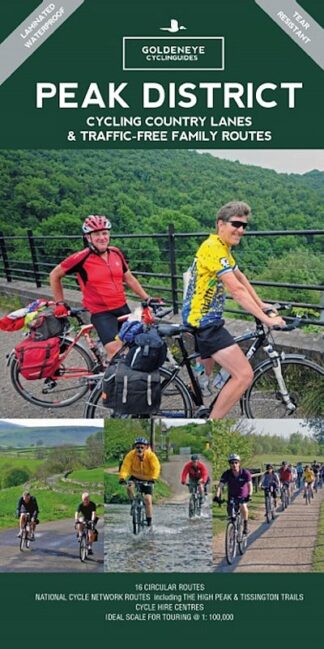
Description
Peak District Goldeneye Cycling Map
Cycling Country Lanes and Traffic-Free Cycle Routes
The Peak District Goldeneye Cycling Map is part of the Country Lanes and Traffic-free Cycle Routes series.
Printed on tough laminated paper, it is ideal to take on your rides. It shows 16 circular routes on quiet roads or on the Peak District’s network of cycle trails.
In the Tissington, Manifold and High Peak Trails, the White Peak has some of the longest converted railway tracks in the country. A great way for families and inexperienced cyclists to enjoy traffic-free cycling.
The Peak District is a remarkable place – from the north, the upturned horseshoe of high, gritstone moors and crags of the Dark Peak extend southwards to the east and west of the contrasting limestone plateau of the softer pastoral landscape of the White Peak itself incised by the valleys of the Derbyshire Dales.
These differing landscapes offer some of the best country lane cycling in Britain.
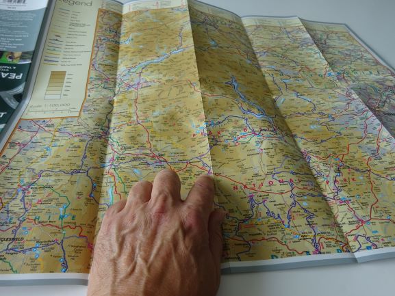
The Peak District Map
EAN Number: 9781859652787
Publication Date: May 2021, 5th Edition
Format: Map
Prev Published History: 9 781859 65223 7
Size: 245mm x 125mm x 10mm (Spine)
Finish: Concertina Fold, Matt Laminated
Design: Double-sided A2 Sheet
Extent: 24pp
The Map Scale: 1: 100, 000
You can read more on the area in our blog post here: