There’s no doubt, The North Coast 500 (NC500) is a challenging ride. You are guaranteed to encounter relentless ups and downs across Scotland’s vast highlands. But almost everyone who attempts the ride says it was worth it for the beautiful scenery and feeling of accomplishment.
What is the NC500?
Created by the North Highland Initiative in 2014, the NC500’s goal was to encourage economic growth in the relatively unknown northern highlands. Often referred to as Scotland’s Route 66, the NC500 is a road trip circling the northern region of the country, starting and ending in Inverness. This does unfortunately mean there will be traffic along certain parts of the route. However, the occasional busy section won’t detract from the freedom and serenity you feel when you have the road to yourself. The Cyclist version of the route also misses the A99 and A9, opting to travel inland as opposed to following the east coast.
Why cycle the NC500?
You don’t need me to tell you why people choose to cycle such a challenging and scenic route. Every day will be unique and push you to the limit, making the feeling of accomplishment even more satisfying. By cycling this famous road trip, you can discover Scotland for yourself and learn about all the hidden gems of the highlands. We’re bringing you some of the top locations and some alternate routes to reach spots not on the normal cycle path. NO photos in this blog – you’ll have to see the sights for yourself.
The highlights
Applecross peninsula
Since this list is all about the best views and beauty of the NC500, the Bealach na Ba Pass, Applecross and Sands had to be mentioned. The Bealach na Ba is one of the greatest climbs found in Britain. The 9.1km uphill road rises 626m along winding roads that snake up to the top of the mountain. Depending on the weather, you might find yourself with stunning views or be deep in the clouds.
After completing the climb, you can enjoy the speedy decline (descent?) to the coast and Applecross Bay. Follow the path north to find Applecross Sands, a stunning beach with sand dunes, perfect for a break after such a tough section of the ride. This entire area from the climb to the sands is unmissable and on many people’s bucket lists to drive and ride. Road users have been known to be very patient and generous on the path up, even applauding the cyclists braving the climb.
North West Highlands GeoPark
Looking for somewhere to pause and take a breather? The area surrounding the Geopark is ideal for nature lovers. If you’re in no rush to reach the finish line, or get to your next accommodation, spend the morning cycling around the local area. Visit the lochs or backtrack to Allt Chranaidh Waterfall. When you’re ready, move on to Kylesku Bridge – just don’t forget to take a photo, it’s stunning.
Dunnet Head to John o’ Groats
Dunnet Head is the most northern point of mainland Britain and a must visit when completing the NC500 in our opinion. Sadly, the cycle path will miss Dunnet head as it leads to the A99. If you’re willing to add a few extra hours to your ride, and backtrack to Melvich, you can see more of the North Coast before heading south. This will be the last of the coastal roads for a while, so can be well worth the trip for ocean lovers. Once you’ve taken a photo of yourself or your group at the furthest northern point, you do have the option to continue or return to the route straight away.
If you choose to head back immediately, you’ll only be adding 4 hours to your trip. Stay on the northern path following the coastline to John o’ Groats and you’ll see far more scenery. This path passes great spots such as the Castle and gardens of Mey and Scotland’s Haven. Both are incredible sights rich in history and natural beauty. Do keep in mind, the further East you travel the longer you must backtrack (unless you want to take the A roads south). To reach John o’ Groats adds approximately 6 hours of travel time to your trip, counting the journey there and back from Melvich.
Glenmorangie Distillery
Directly on the classic NC500 path is a whisky distillery with open doors waiting to offer you a bit of warmth before you complete your ride. Tasting a true Scotch whisky is an excellent prize for being so close to the finish line. We must emphasise we’re only suggesting a taster, not a full glass or bottle (we do not encourage people to drink and ride). That being said, if you’ve got the room, no harm in purchasing a bottle to share for when you’re finally off the road.
By following an alternate route, you can stop off at Glenmorangie without touching the A roads and explore the surrounding areas. You can happily avoid the A9 after Glenmorangie by circumventing the Hill of Fearn and follow the coastal path south through some beautiful villages. This route allows you to truly go your own way and discover Scotland for yourself.
Where to plan
If you’re thinking of braving the North Coast 500, then be sure to prepare and read through the advice of people who have completed the ride in the past. What bikes are best? Where are the nicest B&Bs and camping spots? Are there any particularly treacherous stretches? Where can I get a physical map for the journey? Once you can answer questions like these, you’ll be ready for your trip.
That made me wonder about my own list. I decided this would involve longer routes that would make complete staycation holidays in their own right, and I would spread them wide around the UK. So here goes:
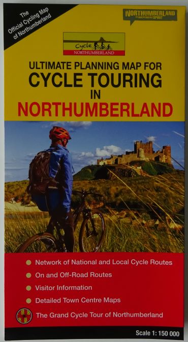
Northumberland and Tyneside must have some of the best cycling in the country.
The area is blessed with flat family rides, longer routes into the hills and mountain biking routes.
You can always find quiet roads. There is coastal riding as well as the northern section of the Pennines and even the classic ride out to Holy Island.
The county is also home to some of the best waymarked cycle routes in the country, including sections of the C2C, the Reivers Route, Hadrian’s Cycleway and Coast & Castles South. Plus, there is the off-road waymarked Sandstone Way.
Below you will find sections on:
Suggested cycle touring and cycling holiday hubs
Gentle / family bike rides
Circular cycle tours
Guide books and maps for cycle touring
Waymarked long-distance cycle routes
Mountain biking / off-road cycle routes
Cycle-friendly holiday accommodation
Cycling maps and guide books, of which there is great range:
Suggested cycle touring and cycling holiday hubs in Northumberland
Alnwick is a really interesting town, full of shops and eating places, and is quite central to some very good riding. The castle is iconic, and the beach and village of Alnmouth just down the road.
Bamburgh is much smaller, but is a glorious village right on the coast and under the walls of the castle. It is on the Coast and Castles waymarked cycle route.
Rothbury makes a great place to stay to explore the quiet roads and off-road trails away from the coast. Rothbury lies on the off-road Sandstone Way trail. It is also not far from Kielder Forest with its off-road trails.
Gentle / family bike rides inNorthumberland
The harbour at Amble
In the very south of the area, old railway lines and waggonways have often been converted into fabulous family-friendly cycle routes.
Or you can use the C2C Footprint map to follow the river Derwent on cycle / walking tracks between Rowlands Gill and Hamsterley, within the Derwent Walk Country Park. There are two visitor centres with cafés and toilets.
Further north in Northumberland there are not generally the same off-road family-friendly trails, but the roads are generally reasonably quiet.
The Walkworth and Alnmouth Loop in ‘33 Cycle Rides‘ is 9 miles. It joins two fabulous villages. Walkworth has a fascinating castle, while Alnmouth has a wide and often quite empty beach.
The same guide book has a number of other rides, a bit longer, and on roads, but quite flat. An example is the Seahouses, Bamburgh and Lucker Loop at 18 miles. Perhaps not a route for small children, but older ones should enjoy it. Take care on the roads though.
Berwick-upon-Tweed to Holy Island is 10.6 iconic miles each way. It is a mix of roads and off-road trails by the sea, leading to the tidal causeway across to Holy Island. Don’t get caught out by the tides! Safe crossing times can be found at https://holyislandcrossingtimes.northumberland.gov.uk/. Again, this might not be a route for small children, but for older children, an amazing and memorable route.
Above the beach at Alnmouth
Circular cycle tours inNorthumberland
You are spoilt for choice with circular cycle tours in Northumberland. Here are some examples:
Warkworth and Shilbottle Loop (from 33 Cycle rides). 15.5 miles of country lanes and easy off-road.
More of a challenge would be one of the cycle routes described in Lost Lanes North, a lovely well-photographed book. For example, Into The Wild, ‘a gravel road adventure from the pleasant pastures of the North Tyne into the rugged expanses of the Kielder Forest‘. The book has four routes within Northumberland (and one – Roof of England – including parts of Northumberland, Durham and Cumbria).
The follow-up to the 33 Cycle Rides book, Cycle Rides in Northumberland and Beyond, also has challenging routes, such as Alnwick West & Coastal Gems Road Route, 58 miles and moderately difficult.
Northumberland is the start or finish point for several iconic long-distance cycle routes.
The C2C from the Cumbrian coast to the North Sea is the most well-known and well-cycled of the coast to coast cycle routes. Tynemouth and Sunderland are the end points.
The Reivers Route starts in Tynemouth and loops northwards before finishing back on the Cumbrian coast.
Hadrian’s Cycleway also starts in Tynemouth and runs not far from Hadrian’s Wall across to, again, Cumbria.
The Coast and Castles South route heads north from Tynemouth, passing Alnwick, Berwick-upon-Tweed and the Northumbrian coast to finish in Edinburgh.
The Pennine Cycleway comes all the way up from the Peak District through the Pennines to finish in Berwick.
All of the above are signposted and have specific maps to follow, though their Northumbrian sections can also be found on the map Cycle Touring in Northumberland. That would allow you to join parts of each together to make a circular route within the county.
The Northumberland Mountain Bike Guide has no fewer than 40 rides. They range from ‘sporting’, through ‘energetic’ and ‘strenuous’ to ‘expert’. Examples include:
Boulmer, 11 ‘sporting’ miles
Rothbury Carriage Drive, 7.8 ‘energetic’ miles
Alnwick – Coast and Country, 26.68 ‘energetic’ miles
The ‘Sandstone Way’ is a waymarked off-road 120-mile route between Berwick-upon-Tweed and Hexham. While it is a fantastic route to do in its entirety, the Sandstone Way map also lends itself to day routes. These include:
Berwick-upon-Tweed to Belford, much of it coastal riding and with just short stretches on road. A linear route, so 20 miles each way.
Two routes from Wooler, one a challenging one into the hills, and not waymarked.
Rothbury Loop through the Coquetdale valley and up into the Simonside Hills and Harwood Forest.
The maps and guide books for cycling inNorthumberland and Tyneside
The ‘Cycle Touring in Northumberland’ map and ’33 Cycle Rides’ give great coverage of the area.
For the Sustrans routes, the Sustrans Tyne and Wear and the North Northumberland pocket-sized maps between them cover the whole area and beyond. Or order the National Cycle Network route-specific maps, such as the Coast and Castles South map or the Pennine Cycleway North map, for more detailed maps.
Lost Lanes North is a lovely book, of coffee table quality, with great photography and description. A great gift (either for someone else or for yourself…)
For mountain biking, again 33 Cycle Rides is very good, and then there is the Northumberland Mountain Bike Guide with its 40 routes. While the Sandstone Way will give a wonderful challenge.
Whatever sort of cycling you are looking for, something below will help! Either pop your map or guide into the basket, or click on the link for more detail.
The Cotswolds are rightly known as one of the most glorious parts of the British Isles, and there are many excellent cycling routes in the area.
This is an Area of Outstanding Natural Beauty, and a bike ride taking in villages such as Stow-on-the-Wold, Broadway and Bourton-on-the-Water will confirm that.
Then there are the surrounding gorgeous towns (or in some cases small cities), including Cheltenham, Gloucester, Stroud, Cirencester and – just outside the area – Oxford.
Much of the Cotswolds are in the county of Gloucestershire, but not all, so this blog post extends into west Oxfordshire and southern Warwickshire. For the very southern part of the Cotswolds Area of Outstanding Natural Beauty, see the separate post on Somerset and Bristol.
Gloucestershire also includes country to the west of the River Severn, including the Forest of Dean, so that is included here as well.
Below you will find sections on different aspects of cycling in the Cotswolds and Gloucestershire:
Suggested cycle touring and cycling holiday hubs
Gentle / family bike rides
Circular cycle tours
Guide books and maps for cycle touring
Waymarked long-distance cycle routes
Mountain biking / off-road cycle routes
Cycle-friendly holiday accommodation
Cycling maps and guide books
There are excellent maps and guide books for the Cotswolds, with maps from Ordnance Survey (the OS Tour series) and Goldeneye Maps, plus various cycle guide books, of which more below.
All the maps are listed at the bottom of the page, or you can click on a link to go direct to them in the Bike Ride Maps shop.
So whether you are local to the area, or planning a cycling holiday in the Cotswolds, I hope the following helps.
Suggested cycle touring and cycling holiday hubs in Gloucestershire and the wider Cotswolds
The Cotswolds and Gloucestershire have a wealth of places to stay and possible starting points for cycle touring. These are just some possible places to consider:
Bourton-on-the-Water is quite central in the Cotswolds and so makes a good base, and is of course a beautiful little village
Chipping Norton in the eastern part of the Cotswolds and not far from Oxford, has some very good cycle routes based here
Stroud is a working town, with a great mix of shops and cafés, and is not too far from Gloucester and Cheltenham as well as the honeypot villages of the Cotswolds
The official Cotswolds.com website has more suggestions for places to stay.
From the Ordnance Survey Tour map of the Cotswolds – more details below
Gentle / family bike rides in the Cotswolds
The Cotswolds are a range of hills and so are generally not flat territory for younger families. Having said that, there are some flatter, gentler family bike rides in and around the area.
Cotswold Country Park circular route
An 8-mile ride on generally quiet lanes starting in the Cotswold Country Park near Cirencester.
A diversion will take you into Cirencester, the ‘capital of the Cotswolds’.
A circular 9-mile route on converted mining tracks in the Forest of Dean between Coleford and Cinderford.
The surface is fine and the route is almost entirely traffic-free. So this is very suitable for all the family. A range of bikes can be hired at the start fromPedalabikeway (Cannop Valley, Nr Coleford, Forest of Dean, GL16 7EH.
There are many lovely cycle touring routes around the Cotswolds and Gloucestershire. Below are some special ones, with details of each route in the guide book or map shown:
Bourton-on-the-Water Loop via The Slaughters (from Cicerone’s Cycling in the Cotswolds)
This is a 14-mile ‘relatively gentle’ route involving both road and bridleway cycling, with the author not recommending a road bike for the off-road sections. She suggests on-road detours instead.
It’s a glorious route, starting in the centre of the quintessential Cotswold village of Bourton-on-the-Water and taking in the picturesque Upper and Lower Slaughter.
Chipping Norton Circular Route via Moreton-in-Marsh (from Goldeneye’s Cotswold Country Lanes map)
The Goldeneye Cotswolds map shows three really good cycle tours out of Chipping Norton. This one is 29 miles and takes you on fairly quiet lanes to Moreton-in-Marsh. There are certainly hills along the way, but beautiful little villages and glorious countryside.
The High Cotswolds from Moreton-in-Marsh to Chipping Camden & Stow-on-the-Wold
A 30-mile ride from Moreton-in-Marsh including Stow-on-the-Wolds, Batsford, Chipping Camden and Broadway Tower. A hilly routed with several climbs. Takes in some of the best of the Cotswolds.
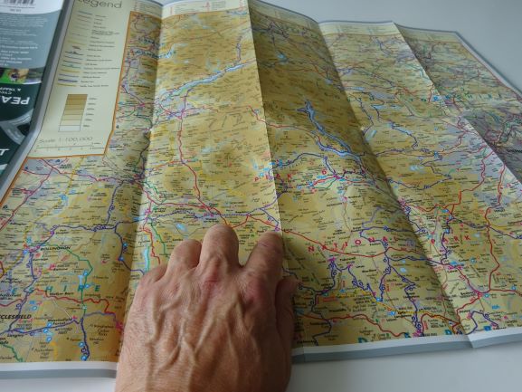
To plan your own tour, you can get an overview of the whole of the Cotswolds and Gloucestershire from the OS Tour map.
However, bear in mind that it doesn’t show contours and is also very big when opened out, and so is not ideal for when you are actually cycling.
The Goldeneye Country Lanes map of the area gives a better idea of height levels and the Sustrans pocket-sized maps have contours shown. Goldeneye maps are particularly robust for carrying with you on a tour.
Waymarked long-distance cycle routes in and around the Cotswolds
There are several waymarked National Cycle Network routes that cross the area. They do not have their own specific maps, but can be found on more general maps.
NCN Route 41
National Cycle Network Route 41 starts in Bristol and should eventually finish in Rugby in Warwickshire.
For now, the signposted route is from Bristol and follows the River Severn up to Slimbridge Wetland Centre. From there it leads into Gloucester and then Cheltenham.
NCN Route 45 is signposted all the way from Salisbury to Chester. It enters our area south of Cirencester and heads west to Stroud. It joins Route 41 for a while as it leads into Gloucester, and then takes on its own numbering again heading north to Tewkesbury.
Route 48 runs northwards from Cirencester to Northleach. When last checked, there was then a gap before the signposted route reappears at Stow-on-the-Wold, heading on to Moreton-in-Marsh and Shipston-on-Stour.
The National Byway is a series of long-distance cycle routes linking places of historic interest, whether they are stately homes, castles, ancient villages or prehistoric sites.
National Byway cycle maps
There is a National Byway route crossing the southern part of the Cotswolds, which has its own map plus signposting on the ground. Be aware that the signposting has not been maintained in recent years, so a map is needed in case signs are missing.
The Cotswolds section is the end part of the National Byway – Midlands. It starts in Chester and heads down through the Welsh Marches before crossing into Gloucestershire south of Ledbury. It then runs east to Tewkesbury and loops around Cheltenham to finish in Cirencester.
The Goldeneye map has 10 routes from around the area, ranging from Easy to Moderate to More Strenuous. Examples include:
Cotswold Water Park, 10 or 13 mostly flat miles. Grade 1
The Broadway Circuit, 15 1/2 miles, of which 7 is off-road. Grade 2
Charlebury Circuit, 18 1/2 miles, of which 14 1/2 is off-road. Grade 2
Cotswold Off-road Goldeneye routes
The Cotswolds Mountain Biking guide book has 20 route guides from right across the region. They range from Easy right through to Killers and include, for example:
Cold Aston ride, 13Km. “While never difficult, there are loose tracks, rutted fields and a couple of steep sections”.
Birdlip ride, 29Km. “Good trails through lovely scenery”.
Nailsworth and Wotton-Under-Edge, 59Km. A “big ride” with “1,600m of climbing and tricky descents”.
Cotswolds Mountain Biking guide book from Vertebrate – the routes
Cycle-friendly Holiday Accommodation in the Cotswolds and Gloucestershire
This section is still to be completed.
The maps and guide books for cycling in the Cotswolds and Gloucestershire
To order a map or guide book, you can click on a link to go to the shop. Or pop one straight in your basket by clicking “Add to basket”.
The Goldeneye maps are both double-sided and made of tough weatherproof paper:
Goldeneye Cotswold Country Lanes map – the Western sideGoldeneye Cotswold Off-road Bike Routes map
The Cicerone ‘Cycling in the Cotswolds’ guide book has 20 good long rides. The Cycle Tours Around Oxford guide book has 20 rides altogether, of which 7 are in the Cotswolds, the remainder in the Chilterns, near the Ridgeway etc.
The Ordnance Survey Tour map has the whole area on one side of one (very large) map. The National Byway map of the Midlands has a route across the southern part of the Cotswolds.
The Ordnance Survey Tour map National Byway Midlands map
by Richard Peace, cycling journalist, guide book author, map designer: richardpeacecycling.com
19th May 2020
With cycling shops experiencing a boom right now it’s clear many people are heading back to two wheels at the time of the virus pandemic, both to get exercise if staying at home or as way of travelling to work without relying on public transport.
If you haven’t ventured into a bike shop in many years you might be overwhelmed by what’s on display – gone are the days of a simple choice between shopper, road bike or mountain bike. There are now many more genres and sub-genres from flat bar road bikes through to fully equipped hybrids and there are even some models made especially for older riders, such as the Islabikes ‘Janis’.
The Islabikes Janis
And the good news is cycling technology has come on leaps and bounds, so great technology like disk brakes and wide range, easy-to-operate gearing is now much more standard when once it was in the realms of the very exotic and expensive.
Buying the Right Bike
Rather than jumping straight to wondering about the categories why not make a list of what you want the bike to do and where you want to use it and you should probably find your list of possibles narrowing down quite quickly.
Before you even hop on the internet or go into a shop to look at models bear in mind the following:
1. Don’t be ambitious
Don’t be too ambitious when buying your first bike, thinking you need an expensive road bike to be able to speed to work in time. Over modest commuting distances that most folk cover they are not that much faster than an average leisure bike that is suitably equipped. Far more important is to get a bike that is comfortable, easy to handle and ride and feels stable – you can still ride fast if you like!
2. Borrow a similar bike
Try and borrow a bike similar in style to what you have in mind for a test ride to highlight any possible problems.
3. Mountain bike?
Getting a mountain bike to use for the daily commute on road – then off-road in your free time – might sound like a good idea but generally isn’t. The large and relatively heavy knobbly tyres when used on tarmac will certainly slow you down and not be particularly pleasant to ride in hard surfaces.
If you are aiming to tackle full on mountain bike trails far better to wait and get a separate bike for this activity. If you only need to go on things like forest dirt roads and canal towpaths that are only moderately bumpy there are plenty of so-called hybrid and trekking models that will tackle both tarmac and unsealed surfaces.
4. The weight of the bike
Weight is quite important but certainly not everything. A suitably equipped bike (and rider) and a comfortable and ergonomic riding position are equally if not more important in being able to get about quickly, efficiently and enjoyably. The more you enjoy it the more you will continue to do it!
There are plenty of bikes on the 12-13kg range which are pretty light to lift around when not riding and they are quite capable of being fast bikes if that is what you want.
5. Looks
Don’t be lead by what looks good – again, think about what you need.
Here’s a list of suggestions of things to think about:
Frame size
Get this right and pedalling will be comfortable on the knees and effective and you will be able to get on and off the bike easily too. Here’s a comprehensive guide to the subject.
Riding Position
Critical to comfort and effective pedalling – you don’t want to be reaching for the bars nor do you want to feel cramped and not be able to feel like you are riding freely. If you feel happier with a sit up straight style of riding you can look for a bike with swept back handlebars and not too much reach between handlebars and seat.
Some bikes have an adjustable handlebar stem so that you can bring the handlebars nearer or further away as required. Numerous Dawes trekking models have this feature, for example this Mojave model, which also features a nice step-thru frame making mounting and dismounting easier.
The Dawes Mojave Low Step
Another step thru model range with comfortable looking swept back bars is the Cannondale Treadwell.
700The Cannondale Treadwell
Gearing
The flatter the terrain you expect to cover, the less gears you need. Extra gears add weight and cost. Seven derailleur gears is plenty for moderate terrain with gently rolling hills. Modern gearing means you can now get 12 speed rear derailleur systems that will tackle most terrain and are easy to control from just one handlebar shifter.
Easiest of all to operate and with the lowest maintenance are hub gears. They are more widely spaced than derailleur gears so 3 hub gears are fine for moderately rolling hill territory and 7 and 8 speed variants are also quite common and will handle much hillier country.
Tyres
If you are riding on good quality tarmac then ‘slick’ road tyres are the best option. If you want to mix tarmac and moderate off road use in railpaths and similar then look for a ‘semislick’ with a moderate amount of raised tread. The Schwalbe G-One is a good example.
A moderate amount of puncture protection is also a good idea – there are various grades and the heaviest and toughest are definitely harder to pedal so best chosen if you only do short flat distances through high puncture risk areas. There are plenty of tyres with a moderate level of puncture protection that will definitely help stave off punctures.
If you are really worried about punctures and have to constantly battle glass shards or hawthorn hedge cuttings there are airless tyres such as Gecko on the market – these are somewhat harder pedal than pneumatic tyres but they are improving and are fine for shorter flatter rides and especially good on e-bikes.
Suspension
Do you really need a bike with front suspension? I have found it adds weight and the cheaper suspension forks relying on a steel spring can be rattly and not perform particularly well (more expensive ones relying on air compression are smoother and more effective). Choosing a wide tyre and getting the tyre pressure just right can often make for a much smoother ride over potholed roads and on towpaths and railpaths.
If your roads are extremely badly potholed and especially if you regularly venture onto very rough tracks you might want to consider a front suspension fork. Full suspension mountain bikes are really for extremely rocky trails only as they take a lot more energy to pedal.
Fitness or Practicality?
If you want to ride to get fit of course it is still possible on a heavier model designed for trundling around town and doing the shopping in a practical way – but it can feel dispiriting putting in a lot of effort on such a bike and not going as far or fast as you want.
Of course, if you want a bike that will get you around town for shopping or very gentle leisure rides and one that will be easy to ride, use and maintain, a practical Dutch-style bike is the ultimate choice. This Ortler is a good example and features wheelguard, fully-enclosed chainguard, kickstand, mudguard, lights and dynamo lighting. This kind of bike is designed to get on and ride and to load up with luggage and to be low maintenance. In other words an everyday bike for everyday activities.
To Fold or Not Fold?
If you regularly combine train and bike it might be worth thinking about folding bikes. The most compact folders are still the world famous Brompton bikes, still made in London. A standard three speed model with mudguards weighs around 11.5kg.
Brompton folding bike
Tern bikes also make great folders and these are also lightweight – although they fold a little larger they have larger wheels and so handling is a less twitchy and more like a full size bike and some models are very speedy indeed.
When test riding a folder also make sure you are happy folding and carrying it!
What Price for Your First Bike?
I would suggest around £300 as a starting point for a decent quality new bike if chosen carefully.
From about £450 you will get something with hydraulic disk brakes like this Voodoo bike, the next real step up in quality.
Is an E-bike Right for You?
E-bikes are a great choice for beginners who may lack fitness but who want to cover longer distances than they would otherwise be able. And for even experienced cyclists they can be game changers in transforming that commute that would leave you tired and sweaty before you have even started your day’s work into a pleasurable, enlivening sweat-free experience.
If used correctly (ie not on full power all the time!) you can also use e-bikes to get plenty of exercise – indeed they will allow you to go further and see more on the same amount of energy on leisure rides.
If you plan to make relatively short rides, of course a non-electric bike will be fine and you probably will get fitter faster – as long it doesn’t all seem too much like hard work at first and you give up altogether. Non-electric bikes are also a lot cheaper than e-bikes of equivalent quality, are lighter (although there are some pretty light e-bikes around) and they don’t have batteries that eventually wear out and cost a lot to replace (though today’s e-bike batteries should last many years if looked after properly).
Buying Your First E-Bike
In many ways the choice of what kind of e-bike is easier than choosing a regular bike – with motor assist you don’t need as many gears as you will get up hills more easily and knobbly tyres are less of a barrier to cycling a mountain bike on tarmac as a good powerful motor will easily overcome the extra resistance (though at the cost of reduced battery range).
If you have doubts about the practicality of e-bikesour myth-buster blog might allay your concerns.
The number of e-bike manufacturers and different motor systems can still make a first e-bike purchase seem like a minefield. The following list of considerations should clarify things.
Frame size and riding position
Those points covered above are still just as important
Motor power or light weight?
Increasingly e-bikes are heading in two opposing directions – powerful machines with bigger batteries usually featuring mid-drives (also known as crank motors and located around the pedal axle) and models that are lightweight and often feature small hub motors and smaller batteries.
Although the latter deliver less power (meaning you do more of the work) they are pretty effective nonetheless. And whilst they have smaller batteries their lighter weight and smaller power requirements help mitigate this (and spare batteries are always available).
Examples of motor systems on mid-drive machines are Bosch, Brose, Shimano and Yamaha and some of the leading manufacturers are Halfords, Cube,Haibikeand Raleighthough there are many many more that use these motor systems.
The lightweight category is dominated by motor systems from Ebikemotion and Fazua, and Ribble and this Boardman are good examples.
Canyon Roadlite is a lightweight ebike using the Fazua motor system
To Fold or Not Fold?
Brompton has it’s own electric model but there are lighter versions from ARCC, Cytronex, Nano and Swytch and a powerful throttle version from Sparticle that also features some of largest batteries out there for a folder.
Cytronex Brompton conversion
If you want something that folds or is compact with more power and range potential and more carrying capacity check out Tern’s range of e-bikes – you would just be sacrificing small folded size and adding some weight when compared to the Brompton variants.
What Price for Your First E-Bike?
There are some decent value budget e-bikes though be aware e-bay bargains are a potential source of disappointment and trouble. £650 seems a the current entry point, but again, at this price point choose with great care.
If you want something for tackling steeper hills a mid-motor option is a wise option as they give motor assistance at a wide range of speeds, from slow, steep hill climbing to cruising up to 15.5mph (beyond which the motor is not legally allowed to assist you). These start around £1600.
This Decathlon model looks a great introduction to mid-drive e-bikes if you want a fully equipped town bike whilst this Carrera hybrid modellooks a good option for sportier riding.
As the specification of e-bikes improves you are often dealing with the same basic types of motor assist system and increasing price tags mean things like bigger batteries, more exotic displays, better gearing systems and so on. Of these the bigger battery is probably the most worthwhile investment in purely practical terms.
Probably top of the tree are Riese & Muller modelswhich are hugely solidly build and come in a real ground breaking range of designs.
Riese and Muller ebikes will tackle any terrain over long distances
Buying your First Bike is by Richard Peace, the author of many cycling guide books, including the best-selling C2C cycle guide, Cycling Northern France, Cycling Southern France and the Devon C2C cycle guide.
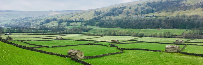
The beautiful Yorkshire Dales can give you challenging cycling, both in terms of distance and hills, although there are also less rigorous cycle routes available as well.
There is no doubt it is a fantastic area – a National Park with fabulous scenery, including Swaledale, Wensleydale, Nidderdale, Ribblesdale and Wharfedale.
Cycling has become very popular in the Dales and you will find a good number of accommodation providers and eateries who very much welcome cyclists.
You will also find there are very good cycle maps and guide books.
In the page below you will find sections on:
Suggested cycle touring and cycling holiday hubs
Gentle / family bike rides
Circular cycle tours
Guide books and maps for cycle touring
Waymarked long-distance cycle routes
Mountain biking / off-road cycle routes
Cycle-friendly holiday accommodation
Cycling maps and guide books
Suggested cycle touring and cycling holiday hubsinthe Yorkshire Dales
There are plenty of areas that can provide you with accommodation for cycle tours or as a hub for daily rides. Here are some suggestions:
Ingleton, on the southern border of the Yorkshire Dales, has easy access from the A65 and lanes leading into the Dales towards the Ribblehead Viaduct and Horton-in-Ribblesdale
Hawes is very central in the Dales, with various lanes and off-road routes within easy reach, and the Wensleydale Cheese factory
Grassington is in the south east of the Yorkshire Dales, within reach of the West Yorkshire towns and cities and the A1 with its links north and south
Settle, on the south-western side of the Dales, has good access to the Dales and is an excellent place to stay over, as well as lying on the Settle-Carlisle Railway
Gentler bike rides in the Yorkshire Dales
The Yorkshire Dales are not known for being flat. Much of it is really quite challenging as regards cycling! There are a few more moderate routes, such as the following:
Skipton to Bolton Abbey
A 13.5 miles gorgeous there-and-back route from Skipton to Bolton Abbey with its tea-rooms, walks and stepping stones over the river.
It’s not a flat road, but is described as ‘undulating’ in the Family Cycle Rides book below.
Allow family time in Skipton as well, with its castle and canal basin.
This is a 12-mile-long mostly off-road route that would suit a family on mountain bikes or similar. It follows a valley bottom and so is flat-ish, though not completely.
The first half, from Reeth to Gunnerside is the flattest, while the continuation to Keld is less so.
It is a really good route, a family-style challenge.
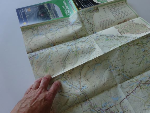
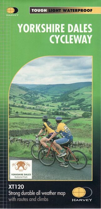
You can create your own routes through the Dales most easily using the Harvey map, Yorkshire Dales for Cyclists, a 1:100,000 map on tough hard-wearing paper.
It’s a clear, beautifully-drawn map, showing long-distance routes and challenging climbs, as well as marking cafés, pubs and bike shops.
‘Lost Lanes North‘ is a great coffee-table book of cycle rides including five in the Yorkshire Dales. There is great photography, plus maps and listings of pubs an pitstops.
Routes include, for example, Up Hill Down Dale – 39 moderate/challenging miles including Settle, Grassington and Malham.
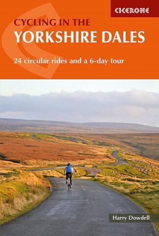
Alternatively, you can follow routes in the Cicerone guide book, 24 circular rides including:
Wensleydale and Swaledale from Leyburn
28 “reasonably challenging” miles according to the Cicerone guide book (route 21) with potential café stops along the way at Reeth, Fremington, Askrigg and Bolton Castle.
The Pennine Cycleway is a waymarked Sustrans cycle route all the way from Derby up the spine of England to Berwick-upon-Tweed.
It arrives in the Yorkshire Dales National Park near Gargrave and takes a fantastic route up the west side of the National Park to Appleby-in-Westmorland over in Cumbria – about 70 miles.
There are potential stops in Settle, Ingleton and Sedbergh on the way.
This is a beautiful and often very quiet territory to explore, and there are direct trains between Gargrave and Appleby for a return route on the famed Settle-Carlisle Railway.
The Pennine Bridleway
The Pennine Bridleway starts in Derbyshire and finishes in Northumberland, with some of the best riding in the Yorkshire Dales. This is off-road riding, some of it reasonably challenging unless you are used to it.
The Yorkshire Dales section starts in Long Preston and goes via Horton-in-Ribblesdale and Garsdale Head to Ravenstonedale and is around 51 miles.
It is best followed using Cicerone’s guide book, which has excellent maps and riding instructions, plus height graphs and what to see and do.
The Way of the Roses is a Sustrans coast to coast route from Lancashire’s Morecambe to Yorkshire’s Bridlington, via – of course – Lancaster and York, the red and the white roses.
It is a very popular and varied ride, 170 miles altogether, including passing through Settle, Burnsall and Pateley Bridge on its way to Ripon and York.
Mountain biking / off-road cycle routes in the Yorkshire Dales
The guide book Cycling the Pennine Bridleway (Lancashire and the Yorkshire Dales) from Cicerone in fact has a number of mountain-bike loops in the Yorkshire Dales very well described and mapped. Examples are below, and a full list can be found by clicking on the link to the guide book itself:
The Settle Loop is 10 miles long, of which 7.5 is off-road. It is quite a challenge with a great deal of climbing, but excellent views and very good downhills to finish. Graded: Medium.
Horton-in-Ribblesdale, Helwith Bridge, Sulber Nick – 12.5 miles, 0f which 6.75 miles off-road. Graded: Easy.
The locations of the loops are shown below:
Another excellent guide book, Yorkshire Dales Mountain Biking from Vertebrate, has 26 mountain bike routes all around the Dales, including around Ingleborough, Whernside and Pen-y-ghent, Swaledale, the Howgills and the Swale Trail.
Routes include an “easy” 16Km from Austwick, an “epic” from Settle to Malham Cove, and “enduro” from the Ribblehead Viaduct and the Tour d’Ingleborough as a 40Km “killer”!
There is also the specific Wharfedale Biking Guide with six routes in the areas of Grassington, Appletreewick and Bolton Abbey.
Cycle-friendly Holiday Accommodation in the Yorkshire Dales
Including the North Sea Cycle Route and the Rallarvegen
There is some amazing adventurous riding in Norway, particularly the Bergen to (nearly) Oslo route including the astonishing Rallarvegen; plus, there is the Norwegian section of the North Sea Cycle Route.
There are some really excellent map sets for cycling these long-distance routes in Norway published by Castor Forlag. The only thing is, they can be a bit hard to get hold of!
The Visit Norway website – watch the Rallarvegen video!
“Following the outskirts of the Hardangervidda mountain plateau, Rallarvegen (the navvie’s road) leads you along the Bergen Railway Line from Haugastøl via Finse, Hallingskeid, Myrdal and all the way down to Flåm by the Sognefjord, or to Voss, located in-between the Sognefjord and the Hardangerfjord.
The route was first opened for cycling in 1974, and the last few years about 25,000 cyclists from Norway and abroad find their way here each year. You can cycle the whole distance in one day, or you can spend a few days and really see the sights along the road.
There is always an option to cycle only parts of the distance according to your own desires.”
The Rallarvegen is just part of a route linking Bergen and (nearly) Oslo.
As it stands today (3rd February 2020) I have in stock the Castor Forlag map set including the Rallarvegen. Altogether the route is 539Km. (As I said, this can be hard to get hold of , so get it while it’s hot is a good tip.)
Norway – Cycle Route from Bergen to Oslo – nearly
The North Sea Cycle Route
Of course there is also the North Sea Cycle Route from the border with Sweden via Oslo, Kristiansand and Stavanger to Bergen.
Take in the fjords and beautiful coastline of Norway on another really adventurous ride.
The North Sea Cycle Route maps are divided in to East and West. The Eastern set is available in English. The Western set is out of print in English but available (and perfectly usable) in Norwegian.
Norway – “North Sea Cycle Route West” – the Norwegian set
The maps are printed on separate cards so that you only need to keep one or two out for the day. Each card has useful phone numbers and addresses on the reverse for accommodation and the like. They come in a tough, plastic box that will keep them safe on your way.
Norway – “North Sea Cycle Route West in Norwegian” – example of hotel info
Click below to order a set of maps – or email me if it says “Read More” – which generally means it is out of stock – and I can tell you if I know when they will become available.
As a cycle guide publisher we’ve done quite a
few shows in the past, displaying our range of cycle books and maps to the
general public and it’s always interesting to get people’s reactions. The good
ones make you feel like you are doing something right but the critical are
often just as helpful.
It’s been very noticeable at the shows that many people pick up our Ultimate UK Cycle Route Planner and once they have done so are extremely reluctant to put it down, studying it intensely and making ums and ahs of interest and enlightenment.
But why is it a different tale with some online reviews who occasionally criticise the map? Typical comments include ‘Not enough detail to follow correctly’ and ‘at best it is an indication of where cycle routes may be.’
So to clear up exactly what the planner is and isn’t and how it will hopefully keep on proving useful to buyers, here’s a bit more background about the contents and how it we envisage it being used.
1. The Scale
With a scale of 1:588,000 this is an overview map for planning your routes so you can see how all the UK’s main leisure cycle routes are interconnected. So it’s not meant for navigation as you ride along.
It’s simply not possible to fit all the UK’s major cycle routes onto one map at a great level of detail – if you tried you would end up with an unmanageably large sheet of paper.
1080mm x 880mm is the unfolded sheet size and is as large as we wanted to go – any larger and it becomes too much of a handful to inspect when unfolded, especially if outdoors in the wind.
It folds down to the size of an OS Landranger map and so will handily fit in the map pocket of an outdoor type coat.
2. What Routes are Shown and Who is it Aimed at?
Leisure riding
The National Cycle Network (NCN)
The UK Cycle Route Planner is aimed at leisure riders. The National Cycle Network (NCN) is shown in its entirety and stands out in bold red along. NCN route numbers are included. As the traffic-free sections (many are former railway lines converted to paths or upgraded canal towpaths) are amongst the most popular these are made to stand out in even broader red and white dashes.
There is more traffic-free info in the form of
green numbers next to traffic-free sections. A separate box out names each
numbered traffic-free section, allowing you to search out more detailed info
online or in other guidebooks. There are 305 traffic-free sections listed and
those that we know to be in rougher condition are indicated with red MB
lettering to show that a mountain bike may be a wise choice on them, even
though the gradients are likely to be unchallenging.
In addition to NCN routes the traffic-free numbering system also identifies easy going traffic-free trails that are not on the NCN but still legally cycleable, such as some sections of the Leeds-Liverpool canal or a route through the Forest of Dean.
More Challenging Routes
For those want more of a challenge the map also shows a selection of routes in dotted green lines. These are National Trails and other long distance off-road routes that allow bikes.
Southe Pennines and Peak District Off-road Cycle Map
A selection of long distance classics are also indicated on the map including the C2C, the Way of the Roses and the Devon Coast to Coast. The map also shows 46 regional signed routes – these are also often multi day rides and fully signed on the ground but less well-known than the iconic long distance routes listed above.
Attractions En Route and Transport Links
To aid the ‘joining up’ of all the above routes the map also shows suggested minor road links and the lengthier sections of traffic-free route sometimes found alongside major roads.
The UK’s rail network and all stations are shown in full for those wanting to access their rides by train.
This allows you to make up your own bike tours; an almost infinite number of possibilities await…
Last but not least you can see where there are attractions on or near the cycle routes such as stately homes, castles, museums and many other historical sites.
3. So Just How Would You Use It?
We have had feedback from an End to End rider
who said they took the map with them en route and found it invaluable. But it
can also be used to discover day rides in your local area or a holiday area you
don’t know that well or to make up your own multi-day rides.
As we always try and make clear to potential buyers, when out cycling you are likely to need a more detailed, larger scale map of the area you are riding in to aid you if you get lost en route.
Where the Planner comes into its own is allowing you to see easily and clearly at a glance all the many different types of route in any area of the UK you choose to look at.
That’s something we think no other publication will let you do.
Richard Peace is the author of many cycling guide books, including the best-selling C2C cycle guide, Cycling Northern France, Cycling Southern France and the Devon C2C cycle guide.
Sustrans’ C2C cycle route is truly a phenomenon; it can fairly claim to be the most popular and widely known long distance cycle route in the UK, completed by many thousands each year. This is despite the fact it makes up only a tiny percentage of the almost 17,000 miles of Sustrans National Cycle Network that spans the UK.
With the longest option amounting to nearly 140
miles and crossing two of the UK’s main mountain ranges (the Lake District and
the Northern Pennines) it’s hardly surprising that cycling the C2C between the
Cumbrian coast and one of the north-east’s main cities is classed as a major
achievement.
If you want to make it an ironman style test of
cycling endurance you could always try and complete the route in a day.
According to Wikipedia the current record actually stands at precisely 7 hours
53 minutes and 03 seconds, west to east, by Joel Toombs and Matt Shorrock on 28
September 2012.
Other amazing achievements cycling the C2C
include crossings by a four year old (cycling a tagalong bike behind his Dad)
and a crossing on large wheeled unicycles!
Of course if you want to make the challenge a
little easier you can always use one of the many luggage services to go
load-free, take more days to shorten the distance cycled every day (between
three and seven days is the norm), use an e-bike or select the easier route
options over harder ones.
Whichever way you look at it, crossing the roof of England by bike and linking the Irish and North Seas in the process will feel like an achievement.
The 5 Reasons the C2C is so Popular
1. The Scenery
Stunning. Magnificent. Breathtaking. These are cliched and overused descriptions of landcsapes in the outdoors industry so just look at the photos if you don’t believe me!
[envira-gallery id=”8982″]
2. The Infrastructure
I’m not really talking cycle lanes here,
although there are some great traffic-free paths such as the one that leads
from Whitehaven to the edge of the Lake District and the ride along the river
Tyne in Newcastle.
Think more of a huge range of accommodation,
from small rural campsites to grand, historic hotels, many aware of the needs
of cyclists (for example offering secure cycle storage). Then there are the
tour operators who can arrange all sorts of packages from comprehensive
holidays with pre-booked hotels to simple luggage transfer services. Many also
offer a service returning you and your bike to your start point if required.
If you want to make the C2C into a bigger adventure you could cycle back west on one of the other coast to coast routes that were put in place in the wake of the C2C’s success. Hadrian’s Cycleway leads from Newcastle to Carlisle and along the Cumbrian coast to Whitehaven, visiting sections of the eponymous wall (a return route of 170 miles though it is possible to shortcut from Carlisle along the Reivers route). There’s also the Walney to Wear that heads back to southern Lakeland.
No doubt the prevalence of charity rides along
the route has also helped put in place all the support services for a C2C ride
that can be as self-organised or as arranged for you as you like.
3. A Walking Past
The idea of travelling coast to coast across
the Lakes and Pennines under human power alone was already firmly embedded in
the public consciousness before the C2C cycle route came along in 1994. The
Coast to Coast Walk is a 182-mile route devised by the legendary Alfred
Wainwright in 1973. Although it takes quite a different route to the cycle trip
it helped hugely to promote the idea of the coast to coast being one of the
most spectacular and satisfying journeys you could make.
4. The Sustrans Fanfare
Sustrans’ launch of the C2C was succeeded the following year by a grant of £43.5 million from the Millennium Lottery Fund to extend the National Cycle Network to smaller towns and rural areas.
Sustrans also launched the “Safe Routes to Schools” project, the money and subsequent massive national publicity no doubt helping to raise the awareness of what Sustrans described at the time as its ‘flagship’ route.
The scenery isn’t the only visually attractive aspect of the route. A novel feature is the C2C’s use of and often huge artworks along the way, pioneering at the time. Here’s another picture selection to demonstrate.
[envira-gallery id=”9006″]
5. The Snowball Effect
Once something gets to such a level of popularity it tends to breed its own mouth to mouth publicity on a big scale.
How many other national cycle routes in the UK could the average leisure cyclist name – Lands End to John o’Groats very likely – but also very likely very few of the many hundreds of others unless they had specific experience of them.
I spent last summer riding many of the finest tracks in the South Pennines and the northern Peak District in order to produce this tough, waterproof map.
For many years, before the days of tarmac, these tracks were the motorways of their day, with incredibly hardy packhorse ponies bringing the necessities of life like salt from as far afield as Cheshire and also acting as the HGVs of the very early cotton and woollen industries in the area, still dotted with early weavers’ hamlets and villages.
Today they are the bedrock (literally in some cases) of some great off-road riding. Add in the canals of the area and you have one of the most varied, visually striking and beautiful areas in the whole of the UK for off-road riding.
Best Track Highlights from the South Pennines and Peak District Off-Road Cycle Map
Along Reddyshore Scout
Here’s my top five scenic tracks and lanes of the area (in no particular order), all detailed on the map as part of longer bike routes:
Colden Clough Road – Just west of tourist magnet Heptonstall, next to Hebden Bridge, this gradually climbing broad track takes you through a wonderful ancient wooded valley then onto moorland scenery to end at a pub.
Reddyshore Scout Gate – A broad, easy to ride track climbs high above the steep sided Upper Roch valley with great views down onto colourful canal boats and small rows of terraces decorating the Rochdale Canal.
Pennine Bridleway – Hayfield to Rushup Edge. A great section of this well-signed National Trail. Rocky in places but plenty of broad tracks too with stunning views over to the highest point in the Peak District National Park, Kinder Scout.
Hope Brink – Actually thought to be much older than packhorse trails, being marked as a Roman road on maps. Fantastic views down Edale from the old direction post at Hope Cross.
Wessenden Valley – Improved by the National Trust who own large tracts of Wessenden Moor, this is now one of the best quality off-road tracks in the South Pennines and makes a wonderful descent from the moors into the attractive old mill town of Marsden.
Family ride highlights
Easy trails around the Longdendale Valley
Family ride highlights on the map include the Longdendale Trail and the Calder & Hebble Canal but there are many more.
The latter has been undergoing a scheme of surface improvements to make it even better for cycling thanks to the excellentCityConnect project.
Daunting No More
I surveyed the whole of the area using electric bikes which I also write reviews of. They mean terrain once unconquerable to someone in his mid-50s with a dodgy back and knees is now a joy to ride through. And I still get a good workout in the process.
Here’s selection of my favourite e-bikes I reviewed whilst riding the routes.
Riese & Muller Delite Mountain Rohloff – A no-holds barred, no expense spared full suspension e-mtb that also comes with rack and lights and a double battery, making it the best off-road e-bike I’ve tried for long distance, ride-all-day off-road e-biking.
Brose Drive S Mag E-bikes – Any e-mtb with a new Brose Drive S Mag motor should give great power yet still be relatively lightweight. Here’s a comprehensive e-mtb test where it is declared winner.
Carrera Vengeance-E – Halfords own brand and great for family and easier emtb trails
Riese & Muller Nevo GX – Great for older riders or anyone who struggles to get their leg over a higher top tube design. One of the very few off-road step thru e-bikes with incredibly sporty and bullet-proof performance as you would expect from this company.
Map Details
There are three main elements to the waterproof map:
A 110 mile ‘Pike to Peak’ circular ‘challenge’ route, linking the famous landmarks of Stoodley Pike near Hebden Bridge to Rushup Edge and Mam Tor in the Peak District National Park. The Pike to Peak is around 75% off-road and uses old packhorse trails and turnpike roads to take in some of the area’s most stunning scenery and attractive towns and villages. The Pike to Peak can be tackled in the form of two smaller loops to make it more manageable as it is bisected by the TPT, meaning you also have the option of two smaller loops of 78 miles and 43 miles.
14 shorter circular day rides along classic trails such as Hope Brink, Wessenden Valley, Holme Valley, Reddyshore Scout, Ladybower Reservoir and the Hope Valley. These range from 8 miles to 26 miles.
20 family trails including the Calder Valley Greenway, Longdendale Trail, Upper Don Trail, Tame Valley Trail, Huddersfield Narrow Canal, Sett Valley Trail and many more.
In compiling the map I tried to pick out the best examples of off-road riding in the area by picking out broad, rideable tracks for adventurous leisure riders (though of course being in the heart of the Pennines there are still plenty of gradients unless you choose one of the family trails on the map). The route choice is ideal for electric mountain bikers getting their first taste of the activity.
The map also features:
Cycle-friendly accommodation listings with a link to internet pages featuring lots more detail.
GPX route files – internet links that guide users to web pages where they can download GPX route files for all the rides and get more background information about the routes.
Derbyshire and the Peak District have a wonderful range of cycle routes, from level (or very gently sloping) converted railway lines to wild mountain bike routes. And everything in between.
Below you will find sections on different aspects of cycling in Derbyshire and the Peak District:
Suggested cycle touring and cycling holiday hubs
Gentle / family bike rides
Cycle touring
Waymarked long-distance cycle routes
Mountain biking / off-road cycle routes
Cycle-friendly holiday accommodation
Cycling maps and guide books
There is an excellent range of maps and guide books to help you plan routes and to help you find your way.
Suggested cycle touring and cycling holiday hubs in the Peak District and Derbyshire
The Peak District has all sorts of accommodation available in many parts of the National Park. The following are just three of the towns with good links to great cycling:
Bakewell, on the Monsal Trail and access to various road and off-road routes
Ashbourne, close to the Tissington Trail and other routes
Buxton, with country lanes leading to both of the above trails and excellent longer routes
Gentle / family bike rides in the Peak District and Derbyshire
Sustrans, the Peak District National Park authority and the local authorities have done a wonderful job in creating family-friendly cycle trails from some of the most scenic disused railway lines in the Peak District.
The Monsal Trail
The Monsal Trail
Starting in lovely Bakewell itself, a quiet lane leads to the Monsal Trail, 8.5 miles of traffic-free cycleway. It’s very popular with cyclists of all types, especially families. There are tunnels to cycle through!
There is even a brilliant shop / cafe / bike hire shop part way along, complete with small play area at Hassop Station.
Starting in Ashbourne, the Tissington Trail is a 13-mile cycle trail through Dovedale. It’s not flat, but the gradients were designed for trains, so not major.
The trail also joins the High Peak cycle trail, yet another former railway line, so you can extend your ride nearly all the way to Cromford, south of Matlock.
The Peak District has a good number of reservoirs serving the cities and towns around the rim of the National Park. Several of them have good cycling by them.
The Ladybower Reservoir is one of the largest of the reservoirs and has a there-and-back route along one side. 7.5 miles long and undulating on first a lane and then a track, the views over the water are magnificent. Perfect for a quiet picnic part way along with the family.
You won’t find this short route in any guide book I have found. It’s a bit of a secret. Ssshhhh!
Just outside Chesterfield are three linked reservoirs. The bottom two have a cycle trail around them through gorgeous woods, probably only 2-3 miles long depending which way you go.
Find the car park at Woodnook Lane, Cutthorpe, S42 7AU. There is no café, but there are toilets and often an ice cream van!
Circular cycle tours in the Peak District and Derbyshire
This is a 12-mile loop, partly on the High Peak Trail and then on quiet roads through the villages of Chelmorton and Monyash. There are some significant hills here. A good challenge.
(And if you want to go further, start at Ashbourne on the Tissington Trail first, before joining the High Peak Trail.)
Waymarked long-distance cycle routes in the Peak District and Derbyshire
The Pennine Cycleway South, National Cycle Network Route 68
The Pennine Cycleway starts in Derby and takes quiet lanes as far as Ashbourne. From there it joins the Tissington Trail before a road finish in Buxton. The route then heads to Glossop before crossing into Yorkshire to bypass Huddersfield, leaving our Peak District area.
Map: Pennine Cycleway South
The Pennine Bridleway
The Pennine Bridleway is designed for mountain bikers and horse riders. It starts at Middleton Top in the south of the region, heading north west. It bypasses Buxton in the hills and heads further north west into Lancashire.
Mountain biking / off-road cycle routes in the Peak District and Derbyshire
The Peak District has of course some great mountain bike routes.
Goldeneye’s ‘Mountain Bike Routes’ map has rides from 10 to 17 miles long, beautifully mapped. Routes include the hills around Bakewell, Eyam, Buxton, Stanage and Edale.
There is also the ‘South Pennines and Peak District Off-Road Cycle Map’ from Excellent Books, designed with long-distance epic routes, day rides and 20 family-friendly off-road rides. It covers the north of the region – Hathersage northwards.
Vertebrate publish two books of off-road and mountain bike routes. Their ‘Cycling in the Peak District – Off-road Trails and Quiet Lanes’ and their ‘White Peak Mountain Biking’. The two books have very different kinds of routes, pretty much doing what they say on the tin.
For tough mountain bike routes, go for the White Peak or for Goldeneye’s map. Or both, of course.
Links to all of the above are below.
Cycle-friendly Holiday Accommodation
Ashbourne on market day
This section is still to be completed.
The maps and guide books for cycling in the Peak District and Derbyshire
There is an excellent range of maps and guide books to select from.
Here is a quick preview of some of them:
The Goldeneye Peak District mapPeak District Off-Road Bike Routes Goldeneye MapCycling in the Peak District – CiceroneVertebrate’s Cycling in the Peak District – Off-road Trails and Quiet LanesVertebrate’s White Peak Mountain BikingPennine Cycleway South Sustrans MapPennine Bridleway South from Harvey MapsSouth Pennines and Peak District Off-road Cycle Map
They are available in the webshop, and you can link to them or put them in your basket below:
Bike rides in Sussex can be on or off-road, by the coast or around the villages, and of course amongst the lovely South Downs. Wherever you ride, cycling in Sussex can give you great views and lovely routes.
In the page below you will find sections on:
Suggested cycle touring and cycling holiday hubs
Gentle / family bike rides
Circular cycle tours
Guide books and maps for cycle touring
Waymarked long-distance cycle routes
Mountain biking / off-road cycle routes
Cycle-friendly holiday accommodation
Cycling maps and guide books
There are also very good guide books and maps to help you plan your routes and find your way.
Suggested cycle touring and cycling holiday hubs in Sussex
There are many excellent places to stay in Sussex for cyclists (see below) and these are just some areas that might suit:
Eastbourne, with access to the Cuckoo Trail and the South Downs Way
Lewes, again close to the South Downs Way, but also with routes north of the South Downs and down to the sea at Brighton
Steyning, just north of Shoreham-by-Sea, on the South Downs Way and also the Downs Link (mostly off-road) cycle route all the way to Guildford
Gentle / family bike rides in Sussex
Lewes Village and the River Ouse
This is a 9.5 mile easy cycle ride close to the town of Lewes on quiet lanes or bridleways.
OR the same guide book (below) has a very short and almost off-road 2.5 mile route: “short, safe and fun”!
Sussex’s Cuckoo Trail runs from Polegate just outside Eastbourne (with an extension into Eastbourne itself) all the way to Heathfield.
It’s 13.5 miles of pleasurable cycling, off-road and mostly hard-surfaced. The first section from Polegate northwards is quite flat, with a gentle climb from Hailsham to Heathfield.
There are a whole heap of great cycle tours you can do in Sussex, and excellent guide books and maps to help you choose. Here are just some of those routes:
Brighton and the South Downs
From Brighton Sea Front to Hove, then up and over the South Downs. Return route via the viewpoint at Ditchling Beacon down to the coast at Rottingdean, and back along to Brighton.
28 miles, challenging in places, but very rewarding!
To plan your own rides in Sussex, the best maps are probably the Sustrans pocket-sized range. ‘Central Sussex and South Surrey‘ covers the bulk of West and East Sussex, while the Hampshire and the Kent Sustrans maps cover the western and eastern sides.
The ‘Central Sussex and South Surrey’ map clearly shows, for example, The Downs Link from Steyning north to Guildford plus links to Shoreham-by-Sea and along the coast to Worthing, Hove and Brighton. It also shows recommended roads for cycling the North Downs.
Waymarked long-distance cycle routes in Sussex
London to Brighton
This is the iconic London to Brighton cycle route as mapped by Sustrans using the National Cycle Network.
68 miles from a start point at Greenwich, via Redhill and Crawley using quieter roads and off-road cycleways. Finishes on the sea front at Brighton, where it meets the South Coast East
The South Coast East
From Brockenhurst in Hampshire, the South Coast East continues on from the South Coast West, through Southampton and Portsmouth to Chichester. From there it joins the coast at Bognor Regis, then takes in the sea fronts at Littlehampton, Worthing and Brighton. It continues either on the coast or near it to Seaford, Eastbourne, Bexhill and Hastings, with Dover its final destination.
Mountain biking / off-road cycle routes in Sussex
The South Downs Way is cycling-permitted for its entire 100 mile length from Winchester to Eastbourne.
You will need a mountain bike rather than a road bike of course, and be comfortable with some hills.
Walking, running and cycling in the Lake District and Cumbria. What could be better?
The English Lake District is perfect for outdoors folk, and – while better known for the hill-walking and running – is ever more a destination for cyclists. Of course, there are hills in the Lake District. Some quite big ones really.
So if you are a cyclist who likes a challenge, that’s great! Plenty to offer.
If you prefer flatter routes, those exist as well, particularly in parts of Cumbria just outside the Lake District itself. You just need to know where they are!
There are a number of cycle maps and guide books to help, and I have some suggestions of different types of routes below, along with the map or guide book that would help you plan your route and find your way.
Below you will find sections on different aspects of cycling in the Lake District and Cumbria:
Suggested cycle touring and cycling holiday hubs
Gentle / family bike rides
Cycle touring
Waymarked long-distance cycle routes
Mountain biking / off-road cycle routes
Cycling maps and guide books
Cycle-friendly holiday accommodation
Suggested cycle touring and cycling holiday hubs in the Lake District and Cumbria
If you are bringing bikes by car, there are all sorts of places in Cumbria and the Lake District that welcome bikes. See below for some suggestions.
I’ve also chosen three possible hubs:
Keswick, for some challenging and adventurous touring, access to the coast and to the C2C cycle route, and close to Whinlatter Forest for mountain bike trails
Ambleside, as above, but also with Grizedale Forest and its range of ability trails and the Langdale valleys not far away
Grange-over-Sands, with access to flatter cycle routes suitable for families, and reachable by rail
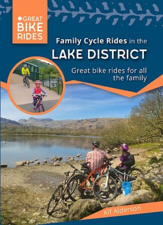
Gentle / family bike rides in the Lake District and Cumbria
When you open a map of the Lake District itself, one thing you tend to notice is the lack of flat land and therefore flat roads suitable for gentle or family cycle rides. You tend to have to look around the outside of the Lake District National Park for cycle rides for young families.
Windermere and Wray Castle
A mix of bridleways and country lanes – 11.5 miles. Includes the shores of Windermere and Esthwaite Water.
Just outside the Lake District National Park, Grange-over-Sands is a really nice little town sitting on the Morecambe Bay estuary. From Grange-over-Sands a five-mile cycle along the quietest of country lanes brings you to the village of Town End (which has a pub for refreshments).
This is a gorgeous ride, thoroughly recommended.
Start off on quite a busy road (so take great care) but very shortly turn right on to the quiet lanes. Then just follow the Sustrans signs until you get to Town End.
Cumbria’s northern peninsula is some distance from the Lake District National Park, and the scenery is very different to the mountains of the Lakes. It is flat! This is a 14-mile ride, and for much of the time you will be looking across the Solway Firth estuary to Scotland.
Park a car at Anthorn, a small village next to the river and cycle west along quiet country lanes.
The route follows the shoreline for about ten miles, stopping at the Solway Wetlands Centre near Bowness-on-Solway for a well-deserved cup of something (and maybe a tour of the RSPB site).
Then turn right at Glasson to cut across the peninsula for another four miles to bring you to the village of Whitrigg, where you turn right again to cycle back to Anthorn.
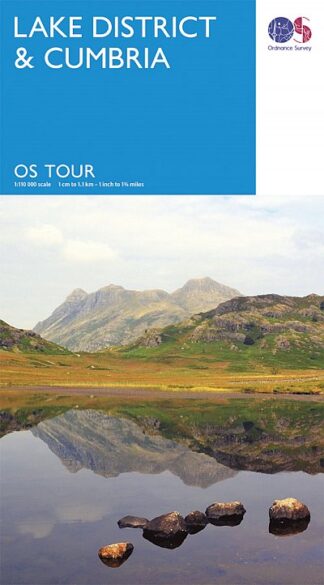
There are two very good guide books for cycle touring in the Lake District and Cumbria, or you can use the cycling maps from Sustrans or the Ordnance Survey Tour Map to create your own cycle routes. You might also choose to read ‘A Lake District Grand Tour’ of which more below.
Suggested routes from Keswick
Circuit of the Skiddaw and Blencathra ranges
33/34 miles and ‘strenuous’. Fantastic views and mostly quiet lanes until the last section back into Keswick.
Park in Keswick (or hire a bike there), heading out on the C2C cycle route to Threlkeld. Follow signs to Mungrisdale then Caldbeck (excellent pub here with its own brewery). Then follow signs to Bassenthwaite, before following the main road (though not too busy) back to Keswick.
Both the CycleCity and Cicerone guide books give good descriptions and maps. See below. Or use the OS Tour map.
Other suggested cycle routes from Keswick:
See the Goldeneye Lake District map to follow these routes.
Over Whinlatter Pass to Lorton, past Crummock Water and Buttermere, back via Honister Pass and Derwentwater. Very challenging.
Cycling to Ambleside via Castlerigg Stone Circle, Thirlmere, Grasmere and Red Bank
The circuit of Derwentwater. Take care on busy days down the east side of the lake.
Over Whinlatter Pass to Lorton, Cockermouth and the reverse of the Workington branch of the C2C
Suggested cycle routes from Ambleside
Ambleside, Ullswater, Thirlmere and Grasmere circuit
41 hard miles according to the Cicerone guide book (below), but well worth it if the legs and lungs will stand it.
The route starts in Ambleside heading very steeply up The Struggle and over the rock-strewn Kirkstone Pass. Then drops beautifully down to Ullswater, following the lakeshore before climbing up again northwards.
Quiet lanes then take you to Threlkeld (choice of pubs available) and then drop you down on to the St Johns in the Vale road (B5322). Cross over the main Keswick-Ambleside road to ride round the very quiet western side of Thirlmere. Then join the new cycle track that avoids climbing Dunmail Raise on the main road. From there you can either fly down towards Grasmere on the main road, or cut off on small lanes.
Don’t use the main road from Grasmere to Ambleside (which is very busy and unpleasant) if you still have the legs for a climb up the challenging Red Bank to bring you back to Ambleside on the Hawkshead road.
Other cycle routes from Ambleside
Cycling in Langdale
These probably best followed using the Goldeneye Lake District map:
Head west out of Ambleside into Little Langdale. Up and over to Great Langdale. Return via Elterwater and Skelwith Bridge.
Again head west from Ambleside, turning south for Coniston. Cycle down the east side of Lake Coniston, then turn back north to follow the lanes through Grizedale Forest (including a stop at the café) and into Hawkshead. Back from there in many places off-road.
Suggested cycle routes from Grange-over-Sands
Circuit of Whitbarrow
This is a 29-mile fairly tough route from Cicerone’s guide book Cycling in the Lake District (see below).
Heading east out of Grange-over-Sands towards the village of Town End the going is straightforward and quite level, at least as far as Levens.
Pedalling north from there in a big loop brings you back to Town End in a figure-of-eight. But then you head for delightful Cartmel. Don’t forget to stop for some refreshment here. The sticky toffee pudding is legendary!
After that, it’s really not that far back to Grange – just enough to shake your pudding down.
The guide book begins with a tour of the Lake District over several days. It’s challenging, of course, but then this is the Lake District! The book then has day rides, many of which are again quite challenging, though some less so. Rides include:
Using excellent Ordnance Survey mapping, the guide book has 20 cycle tour descriptions, the length varying from 24 to 35 miles. Each graded from Easy to Strenuous. Rides include:
This is a lovely coffee-table book with 8 circular rides around the Lake District and Cumbria. It includes maps, wonderful photos and descriptions, plus listings of pubs and pitstops.
It makes a great gift, either to someone else or to yourself!
Planning your own circular rides in the Lake District and Cumbria
You have the choice of either Ordnance Survey or Sustrans cycle maps to plan and ride your own tours of the Lake District and Cumbria.
Ordnance Survey Tour Map of the Lake District and Cumbria
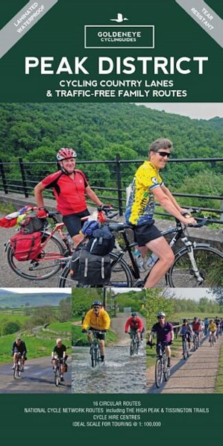
Goldeneye Cycling Country Lanes and Traffic-Free Family Routes – due for publication May 2021
Waymarked long-distance cycle routes in Cumbria and the Lake District
The C2C coast to coast cycle route
For full information on the route, see the C2C page here.
Hadrian’s Cycleway
Normally an east to west cycle route, Hadrian’s Cycleway follows a route within Cumbria from Carlisle down the west to coast to Ravenglass.
The Reivers Route
Originally intended as a reverse C2C route, the Reivers Route is a very good ride in its own right.
Within Cumbria, the Reivers Route map brings you south from Carlisle to Caldbeck, skirting the northern fells to Cockermouth. From there it reaches the coast at Workington, then follows down the coast on mostly off-road routes to the start point of the C2C in Whitehaven.
The Bay Cycleway
Cartmel, on the Bay Cycle Way route
This a newer cycle route, again starting near Barrow, but doing a loop around Morecambe Bay, ending in Morecambe / Lancaster.
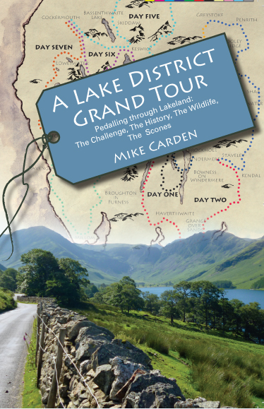
Or you can use the Sustrans and OS Tour maps to make your own route, just as I did to write “A Lake District Grand Tour“, which is not a guide book at all.
It’s more a humorous tale of taking on a challenge to cycle over all of the passes, to see all of the lakes, and to go to the furthest north, south, east and west points of the Lake District National Park.
‘This is one hell of way to see the Lake District National Park! A great description of the grandest of Lake District tours. Get pedalling!’ wrote the Chief Exec of the National Park (no less).
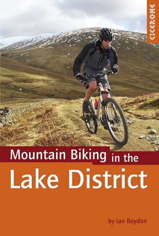
Mountain biking / off-road cycle routes in the Lake District
There are both wild and structured mountain bike routes in the area.
For structured routes, go to Whinlatter Forest, west of Keswick, and Grizedale Forest south of Hawkshead, both with excellent mountain bike routes in Forestry Commission woodland.
There are three main options for maps and guide books for more wild mountain biking.
In the form of a book rather than a map, it details 27 routes, splitting them into Classics, Epics, Enduros and Killers!
Routes include High Street, Borrowdale and Skiddaw.
The third option is Mountain Biking in the Lake District, a Cicerone guide book. Equally good, this one has 24 routes: Short, Medium, Long and Full Day.
Both guide books have more of a focus generally on the south and east of the National Park.
Cycle-friendly Holiday Accommodation in the Lake District and Cumbria
[modula id=”8318″]
Section still to be completed
Buying the maps and guide books for cycling in Cumbria and the Lake District
Previews of some of the maps and guide books are below.
The OS Tour map of the Lake District and CumbriaLake District Off-Road Bike Routes Goldeneye MapLake District Mountain Biking, from Vertebrate PublishingIn and Around the Lake District Cycle Tours
All are available from the Bike Ride Maps webshop. Either click on a link below for more information or add them to your basket.
There is no doubt that cycling in Devon can be a joy.
The county has some fabulous cycle routes, taking in the South Devon coast with its estuaries, beaches and resorts and the North Devon coast with its coves and hills and of course more beaches.
Then there are the cycling and mountain-biking / off-road possibilities on or around Dartmoor and Exmoor.
Devon’s cycle routes include shorter and medium-length circular routes, whether family rides or more challenging ones, as well as long-distance signed Sustrans routes for cycle touring.
Below you will find sections on different aspects of cycling in Devon:
Suggested cycle touring and cycling holiday hubs
Gentle / family bike rides
Circular cycle tours
Guide books and maps for cycle touring
Waymarked long-distance cycle routes
Mountain biking / off-road cycle routes
Cycle-friendly holiday accommodation
Cycling maps and guide books
There are excellent maps and guide books to those routes as well, with maps from Goldeneye Maps, Cycle Maps UK, Ordnance Survey (the OS Tour series), Harvey Maps and plus guide books for the Devon Coast to Coast cycle route.
All the maps are listed at the bottom of the page here, or you can click on a green link to go direct to them in the Bike Ride Maps shop.
So whether you are local to Devon, or planning a cycling holiday in Devon, I hope the following helps.
Starting by the river in Exeter, this is a flat ride of about 8 miles each way, with continuous interest along the way.
The route mostly follows the estuary shoreline, nipping through fascinating Topsham with a finish in Exmouth for a drink and a snack, before setting off back to Exeter.
Park at Plym Valley Railway and cycle north along Drake’s Trail.
The very gently climbing route follows disused a railway line as far as the hamlet of Clearbrook, about 6 miles, taking in viaducts and tunnels along the way. Younger families may choose to turn around at this point.
Beyond Clearbrook, there are short sections on the road to Yelverton and beyond to Tavistock. The town of Tavistock has lots of interest, so make time to stop and wander around. Plenty of tea shops as well…
Tavistock also makes an excellent cycling hub as well, if you are looking for somewhere to stay over and have a range of cycling routes on the doorstep, plus of course walks on Dartmoor. (See cycling hub suggestions below).
If you are cycling from Barnstaple, signs take you beyond the roads around the town and quickly onto the old railway line / now cycleway that parallels the estuary of the River Taw. It’s very easy and pleasant cycling.
At the village of Instow the Taw meets the estuary of the Torridge, and across the far side you will see Appledore. Carry on and you come to Bideford’s village east of the Torridge: East-the-Water. For those wanting a short ride, you can walk across to Bideford’s town centre just on the far side of the bridge (note – this is the second bridge you come to, not the first, which is the main A39).
After Bideford, the estuary turns into river, with the Tarka Trail criss-crossing through lovely countryside perfect for otters (after all, the route is named after Tarka the Otter, written and set just here).
Just short of Great Torrington is a café as part of the old railway station, which can be a good place for a break before the return journey. Great Torrington itself is up a very considerable hill, a nice place, but you will need good lungs going up.
The return journey to Barnstaple is just as pleasant. Look out for otters…
Of course, you can also cycle the other way out of Barnstaple. Five miles away, hugging the northern side of the Taw estuary, the cycleway leads to Braunton,
The routes are marked on Goldeneye’s robust waterproof map and have brief descriptions of the type route. For example, from Ivybridge there is the “Southern Edge of Dartmoor“, 29Km/18miles through South Brent, Avonwick, Ugborough and back to Ivybridge. “A quiet route with long, easy sections between few steep climbs.” The mapping is very clear and easy to follow.
The distances are 13 to 25 miles, but you can also join routes together to create longer ones.
So as not to be too bulky, one side has south Devon and the southern half of Dartmoor, while the other side has the northern half.
Circular day rides in North Devon and around Exmoor
Ilfracombe – the start of the Devon Coast to Coast
The Devon C2C cycle route is one of the best fully signed Sustrans National Cycle Network routes.
At 99 miles, it is normally ridden over two or three days, though side trips to Dartmoor or Sir Francis Drake’s house can make for a longer journey.
It starts at Ilfracombe on Devon’s gorgeous north coast with some up and overs to Barnstaple.
From there it follows the Tarka Trail inland and then the Granite Way from Okehampton to Lydford on to the fringes of Dartmoor. At Tavistock the route joins Drake’s Trail (above) gently dropping towards Plymouth.
Much of the route is on disused railway lines, so the gradients are generally very kind.
The end of the Devon C2C is on the iconic Plymouth Hoe.
Dartmoor and Exmoor offer some great off-road riding, some of it relatively easy, other sections more challenging. There are some excellent maps and guide books.
Some hints on a route through western Scotland that sounds very, very good – from John A in Ardrossan:
The best cycle route to Ardrossan from Inverness
Take the A862, then hang a left on to the A833, that comes out at Drumnadrochit, halfway down Loch Ness. This avoids the very busy A82. Then link up with a trail at Strone to Invermoriston & join the Great Glen there. This off road route will take you all the way to Fort William, avoiding the manic A82 & possible road rage.
In Fort William there’s a new Travel Lodge, with Brewers Fayre below, superb value. From Fort William head south on the A82 for around 14 miles, then take the A828 to North Connel, then A85 to Oban, so you only suffer The A82 for 14 miles.
From Oban head south on the A816 & I recommend booking ahead at the Kilmartin Hotel, very friendly & good value. From Kilmartin it’s only 50 miles to Ardrossan via Arran, 2 ferries, 1 from Claonaig to Lochranza & the other from Brodick to Ardrossan, hey presto, great trip.
Distance for this route is around 200 miles of breath taking scenery, well worth the effort.
Hope this info can be of benefit to fellow cyclists – enjoy!
John, Ardrossan
SEARCH FOR A MAP OR GUIDE BOOK
SEARCH THE WEBSITE
POSTAGE
We will send your map or book by Royal Mail (or sometimes a carrier for larger items) within the UK, and prices for UK deliveries are:
Up to £12 = £1.75 | £12.00 to £15 = £1.99 | £15.01 to £20 = £2.25 | £20.01 to £25 = £2.49 | £25.01 to £29.50 = £2.99 | £29.51 to £40 = £3.99 | £40.01 to £50 = £4.99 | £50.01 to £75 = £5.99 | £75.01 to £100 = £7.50 | £100.01 to £200 = £10.00 | £200.01 to £500 = £20.00
See our Terms, Conditions and Postage page for full details.
This website uses cookies to improve your experience and not for any other reason. Feel free to accept or reject! How to rejectACCEPT
Privacy & Cookies Policy
Privacy Overview
This website uses cookies to improve your experience while you navigate through the website. Out of these cookies, the cookies that are categorized as necessary are stored on your browser as they are essential for the working of basic functionalities of the website. We also use third-party cookies that help us analyze and understand how you use this website. These cookies will be stored in your browser only with your consent. You also have the option to opt-out of these cookies. But opting out of some of these cookies may have an effect on your browsing experience.
Necessary cookies are absolutely essential for the website to function properly. This category only includes cookies that ensures basic functionalities and security features of the website. These cookies do not store any personal information.
Any cookies that may not be particularly necessary for the website to function and is used specifically to collect user personal data via analytics, ads, other embedded contents are termed as non-necessary cookies. It is mandatory to procure user consent prior to running these cookies on your website.